Trusted by 50,000+ Professionals

GeoSnap GPS Camera App for Advocates & Lawyers

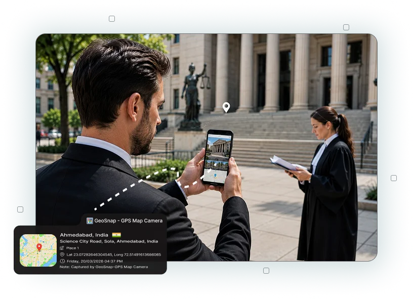
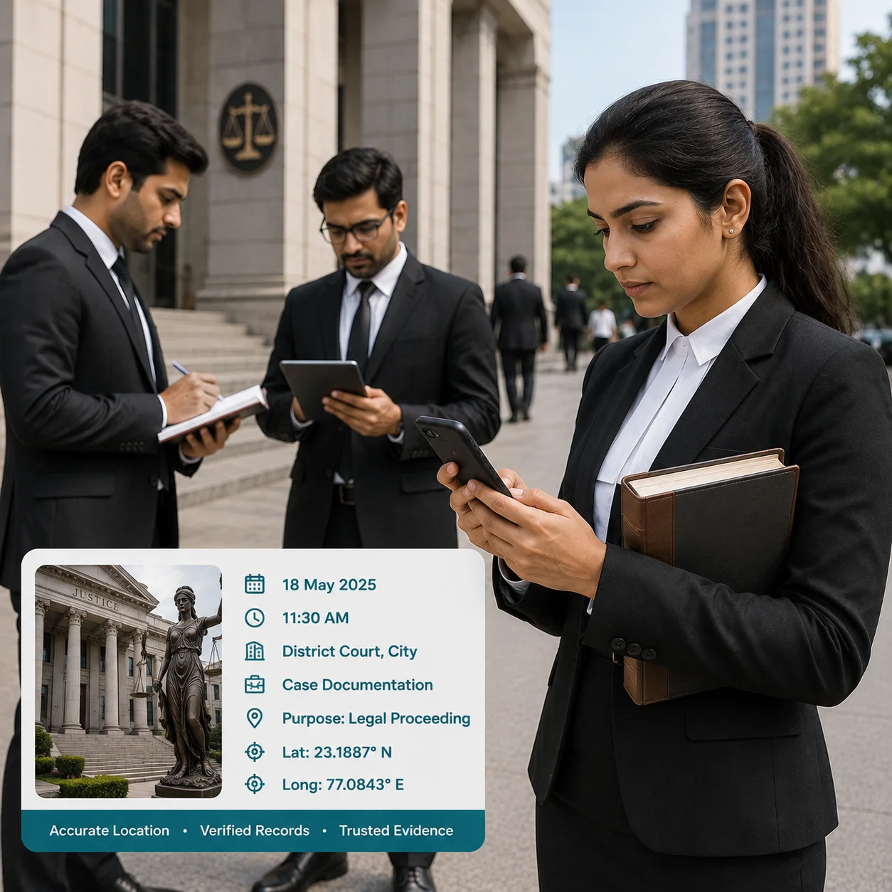
For advocates and lawyers, accurate documentation can be important when handling property matters, inspections, disputes, client cases, and legal proceedings. GeoSnap GPS Camera App for Advocates helps legal professionals capture photos with GPS coordinates, location, address, date, time, and map information directly on the image.

Whether you are visiting a property, documenting a site condition, recording damage, or maintaining case-related records, GeoSnap helps create organized visual documentation with relevant location and time details.

GPS Map Camera

Why Choose GeoSnap for Legal Documentation?

Legal professionals often need clear and organized photographic records during field visits and case preparation. GeoSnap makes it easier to capture and maintain photos that include useful location and timestamp information.

Accurate GPS Location Tracking

Capture Photos with GPS Location

The GPS Camera App for Lawyers automatically adds location information to photos, including GPS coordinates, address, latitude, longitude, and map details.

Automatic Date and Time Recording

Record Date and Time Automatically

The Date and Time Stamp Camera for Advocates records when a photo was captured, helping you maintain chronological documentation of site visits, inspections, and other activities.

Organized Property Documentation

Document Property Conditions

During property disputes, inspections, or verification visits, use GeoSnap to photograph buildings, land, construction work, boundaries, damages, and other relevant conditions with location information.

 Maintain Case-Related Photo Records

Maintain Case-Related Photo Records

Keep photographs related to different cases organized and easy to identify. Location and timestamp information can provide useful context when reviewing photos later.

Custom Property Information

Document Site Visits

Advocates may need to visit properties, accident locations, business premises, construction sites, or other locations. GeoSnap helps record these visits through location-stamped photographs.

Add Important Photo Details

Add Important Photo Details

The GPS Photo Stamp App for Advocates can display useful information on captured images, helping you identify where and when the photograph was taken.

Simplify Legal Documentation

Simplify Legal Documentation

Instead of manually recording the location and time for every photograph, GeoSnap automatically places relevant details on the image, reducing repetitive documentation work.

Faster Reporting & Client Updates

Keep Visual Records Organized

Create a clearer visual record of inspections, property conditions, damages, documents, notices, and other case-related observations.

How Advocates & Lawyers Use GeoSnap

Property Disputes

Property Disputes

Use the GPS Location Camera for Lawyers to document property boundaries, structures, construction conditions, damages, access points, and other physical details during site visits.

Site Inspections

Site Inspections

Capture photographs during inspections with GPS coordinates, address, date, and time information to maintain a structured record of the visit.

Property Documentation

Property Documentation

Document residential properties, commercial buildings, land, construction sites, and other locations when handling property-related legal matters.

Damage Documentation

Damage Documentation

Capture location-stamped photographs of visible property damage, accidents, construction issues, or other physical conditions that need to be documented.

Client Site Visits

Client Site Visits

Maintain organized photographs from client-related site visits so you can easily identify where and when each photograph was captured.

Legal Notices & Documents

Legal Notices & Documents

Photograph notices, boards, documents, property signs, and other physical materials while maintaining location and timestamp details.

Construction & Development Disputes

Construction & Development Disputes

Record construction progress, incomplete work, structural conditions, or site-related issues using GPS-stamped photographs.

Field Case Documentation

Field Case Documentation

Use GeoSnap during fieldwork to create a visual record of locations and conditions relevant to a legal matter.

Make Legal Field Documentation More Organized with GeoSnap

From property inspections to site visits, advocates and lawyers often work with information collected outside the office. GeoSnap GPS Map Camera helps turn those field photographs into organized visual records by adding location, date, time, address, coordinates, and map details.

With the relevant information visible on the photograph, it becomes easier to identify the context of each image when reviewing your records later.

Start using GeoSnap to simplify location-based legal documentation.

Why Advocates Choose GeoSnap App

GeoSnap combines photography with GPS and timestamp information to help advocates maintain better-organized field records.

  • Capture GPS-tagged legal photographs
  • Automatically record date and time
  • Document property and site conditions
  • Record locations during field visits
  • Add address and GPS coordinates to photos
  • Maintain organized case-related photographs
  • Document visible damages and physical conditions
  • Reduce manual location and timestamp recording
Staff Love GeoSnap
            Field Documentation

Frequently Asked Questions

GeoSnap GPS Camera App for Advocates is a location-stamping camera app that allows lawyers and legal professionals to capture photographs with GPS coordinates, address, date, time, latitude, longitude, and map information.
The GPS Camera App for Lawyers can help with property inspections, site visits, damage documentation, field records, construction-related matters, and other situations where location-based photographs are useful.
Yes. The Geo Tagged Camera App for Lawyers can display location-related information such as GPS coordinates, address, latitude, longitude, and map details on captured photographs.
Yes. GeoSnap can automatically display the date and time on photographs, helping you maintain a chronological record of field activities.
GeoSnap can help create location- and time-stamped photographic records for documentation purposes. However, whether a photograph is accepted as legal evidence depends on the applicable laws, court procedures, and the specific circumstances of the case.
A GPS Photo Stamp App for Advocates can make it easier to identify where and when a photograph was captured, reducing the need to manually maintain separate location and timestamp records.

What Our Users Say

"GeoSnap has transformed how we document site inspections. Our clients and government reviewers now accept our photo evidence without question — the tamper-proof stamps give everyone confidence."

Rajesh Kumar
Civil Engineer, Delhi PWD

"As a real estate broker, I share property photos with clients abroad. GeoSnap stamps give them the confidence to trust what they're seeing. My conversion rate improved significantly after using it."

Priya Mehta
Real Estate Broker, Mumbai

"We use GeoSnap for our environmental field surveys across remote tribal zones. Offline GPS capture is a lifesaver. Reports are now automatically organized with location-stamped evidence. Outstanding tool."

Anand Sharma
Field Officer, MoEFCC

"I'm a solo traveler and GeoSnap is my favorite app. Every photo gets tagged with the exact place — I no longer need to write notes about where I was. My travel blog is so much richer now!"

Sneha Nair
Travel Blogger, Kerala